Section 202(e) of the Executive Order charges the National Park Service to provide recommendations that will “expand public access to waters and open spaces of the Chesapeake Bay and its tributaries from Federal lands and conserve landscapes and ecosystems of the Chesapeake Bay.” An early draft report addressing this charge will be available to the public in September, with a revised draft released for public comment and engagement in November.
Conservation and public access strategies for the Bay region must honor and strengthen the integrated relationship between nature and culture. Conservation approaches that support multiple social goals are essential to restoring the Bay and to sustaining quality of life in a rapidly developing watershed. With development and climate change posing threats to the Chesapeake’s treasured landscapes, the region’s important places may soon be altered irreversibly or lost forever. Swift and measured conservation is essential.
The Bay’s most important landscapes are those that reflect and promote a positive and productive relationship between people and place. Some of these landscapes are wild, sustaining wildlife, improving air and water quality, and reducing flood damage. They are also places where people live, work, learn, and recreate. They include wooded parks, water trails, small town main streets, urban green spaces, and historic homesteads and battlefields. They also encompass farms, forests, and waterfronts that add billions of dollars to the region’s economy.
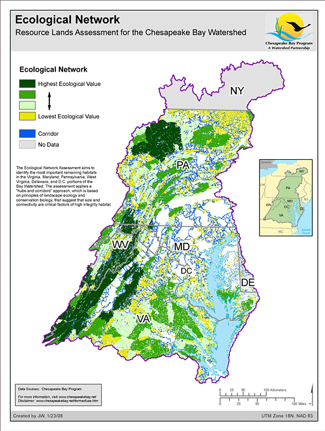
Some 18 percent – or 7.3 million acres – of the Bay region is considered permanently protected, but urgent conservation needs exist for hundreds of thousands of valuable, high priority acres. Local jurisdictions, state and federal agencies, and private organizations are already at work on this challenge. These groups have developed systems for recognizing special landscapes and produced some goals and strategies for conservation. These recognition programs tend to sort landscapes by their ecological or cultural values. Ecological recognition systems emphasize habitat and watershed functions. Cultural recognition systems emphasize the interplay between people and place: working landscapes, historic sites, and recreational areas. However, any large, important landscape in the Bay region will inevitably represent values from both categories due to the long and intimate relationship between land, water, and people.
The Chesapeake region’s states—Maryland, Pennsylvania, Virginia, Delaware, New York and West Virginia—have identified the need to conserve some 4 million acres of land: including both working landscapes (farms and forests) and areas of ecological significance. Yet two-thirds of that amount – 2.7 million acres – remains unprotected today. This alone represents an extremely significant conservation need, but it also represents only one portion of the full need. This figure does not include other state conservation objectives from Pennsylvania, New York, Delaware, or West Virginia. Nor does it include any conservation goals for culturally important landscapes beyond Maryland’s farmland preservation goals.
The scope of conservation needs expands still further when considering the existing gaps in both conservation goals and the recognition systems that support them. For example, the region lacks consistent goals and recognition systems for cultural landscapes. The problem is compounded by the need to know more about the ways in which the broad spectrum of Americans define and relate to their landscapes—including African Americans, Native Americans, Hispanic Americans, farm communities, and urban and suburban residents. There is also a considerable gap between the existing conservation goals and on-the-ground actions needed to achieve them.
The state of public access to the Chesapeake Bay is also problematic. Just 2 percent of the Bay’s shoreline is accessible to the public, providing places where people can enjoy the natural and cultural bounty of the Chesapeake region. State and local budget constraints are also threatening the core operation of existing facilities.
Approximately 783 public access sites exist in the six Bay states and the District of Columbia, provided by a range of federal, state, and local government agencies, as well as some private nonprofit organizations and creative partnerships. Forty-six federally managed properties provide a portion of these sites. Most access on federal land is provided through the National Park Service, Army Corps of Engineers, and U.S. Fish and Wildlife Service.
Notable progress has been made in providing thematic visitor experiences of the Chesapeake's landscapes by connecting diverse sites across multiple jurisdictions. These popular offerings include the Chesapeake Bay Gateways and Water Trails Network, Captain John Smith Chesapeake National Historic Trail, Star-Spangled Banner National Historic Trail, and Potomac Heritage National Scenic Trail. Although federal agencies coordinate and/or support these trails, the great majority of participating sites are on state, local, and non-governmental properties managed by non-federal entities. These partnership systems highlight the important role of federal agencies, while demonstrating that the amount of public access available on federal land is dwarfed the amount of access available at state and local sites.